Sutherland 2 Surf
Flora Street, Sutherland to Don Lucas Reserve, Cronulla
-
Start
07:30
Finish 11:00
Important Event Information
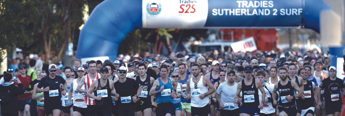
More than 7,000 participants are expected to take part in the annual Sutherland2Surf fun run and walk on Sunday 19 July. The 11km event will start in Flora Street, Sutherland, and will travel via the Kingsway to finish at Don Lucas Reserve in Cronulla.
Transport
- The closest train station to the start line is Sutherland on the T4 Eastern Suburbs & Illawarra Line. A number of regular route buses also make stops near the start line on Flora Street.
- Free event shuttle buses will run regularly from Cronulla High School to help get participants to the start line. Services will also return to Sutherland from the High School after the race.
- Traffic will be heavy in the area while closures and detours are in place, so participants are encouraged to catch public transport to avoid being delayed arriving at the start line. You can find real-time traffic conditions at livetraffic.com.
- Please note: M1 Metro North West & Bankstown line and the L2 Randwick and L3 Kingsford Line Light Rail services will not run on the weekend.
- Remember, you'll need to use an Opal card or contactless payment card/device when travelling on public transport to and from the event. Register your details online at Opal or via the Opal Travel app ahead of time.
Road closures
Roads will start to close around the start area in Sutherland from 5am and will remain closed until approximately 9.15am. Roads will continue to close from 7am with all closures in place by 7.40am. Roads in Sutherland will begin to reopen from 8am with all roads reopened by 10:45am.
For detailed road closure information
- Sutherland2Surf 2026 road closure map (pdf 767KB)
- Interactive road closure map
- Visit livetraffic.com.
Stay connected
Keep informed on the day and get real-time updates on the event, public transport services and road closures.
- Event updates:
- Follow s2sfunrun on Facebook and @s2s_wandaslsc Instagram.
- Transport updates
- Follow @TrainsInfo, @BusesInfo, @FerriesInfo and @SydneyMetro.
- Opal Travel app is the official Transport for NSW app to help you get around public transport.
- Road closures and traffic updates:
- Follow @LiveTrafficNSW on X, Live Traffic NSW on Facebook and download the Live Traffic NSW app.
- For maps and detailed closure information visit livetraffic.com.
Opal
You can use an Opal card for all modes of public transport in Sydney and surrounding regions, including metro, trains, buses, ferries and light rail.
Remember to top up your Opal card before you travel to avoid waiting in line at top-up machines. You can top up your card online or at an Opal retailer.
More ways to pay
If you have a contactless-enabled American Express, Mastercard or Visa debit or credit card, or a linked device, you can use it to pay for your travel by tapping on and tapping off at Opal card readers. Available on all public transport, contactless payments are another way to pay on the Opal network. Adult Opal fare pricing applies and you will receive Opal benefits, including daily and weekly fare caps.
Sydney Metro services are high-frequency, driverless trains running between Sydney’s north-west and south-west via the city.
However, Metro services will not run due to planned maintenance. Plan your trip using the Trip Planner.
Trackwork – Saturday 18 and Sunday 19 July
- Due to essential testing to connect Southwest to the M1 Metro North West & Bankstown line, metro services will not run on the entire line between Tallawong and Sydenham.
- Buses replace services between Tallawong and Chatswood only.
For Metro service disruption information, check travel alerts and trackwork or plan your trip using the Trip Planner.
The closest station to the start line on Flora Street is Sutherland on the T4 Eastern Suburbs & Illawarra Line. The station is about a 5-minute walk from the start line.
The closest stations to the finish line are Cronulla and Woolooware on the T4 Eastern Suburbs & Illawarra Line.
Trackwork
Planned trackwork is taking place on Sunday 19 July and may affect how you travel to and from the event. Plan your trip using the Trip Planner.
- Detailed trackwork information will be available closer to the event date.
Trackwork is carried out on an ongoing basis to maintain the safety, reliability, and efficiency of the Sydney Trains network. Trackwork may affect how you travel so allow plenty of extra travel time and plan ahead. Check travel alerts and trackwork or use the Trip Planner.
Free event shuttle buses
Free shuttle buses will run from Cronulla High School, Bate Bay Road Bus stop between 5:45am and 6.45am to help participants get to the start line, Eton street Bus Stop, Sutherland.
After the race, shuttle buses leave Cronulla High School, Bate Bay Road Bus Stop to return to Eton Street Bus Stop, Sutherland between 9am and 11am.
Regular bus services
Buses will run to a regular Sunday timetable. A number of bus services make stops near the start line on Flora Street and leave from the finish line in Cronulla. Plan your trip by bus using the Trip Planner.
Bus diversions and changes:
While roads are closed for the event, some bus services will be cancelled and some will start and end trips from different stops.
- Route 477: services between 7am and 10am will be diverting around the Kingsway via The Boulevarde and Kiora Road in both directions. Services to Miranda will terminate at Kiora Road, north of the Kingsway. Services towards Rockdale will start from Kiora Road, north of the Kingsway.
- Route 969, 971, 975, 985 and 987: some early morning services will not run or run to a changed timetable and stopping pattern due to road closures:
- Route 969 service at 8.10am from Nullaburra Road, Caringbah to Miranda will not run.
- Route 971 services at 8.06am from Cronulla to Miranda will not run. The 8:45am service from Miranda will be diverted via Kiora Rd, President Av, Willarong Rd, Caringbah Rd, Port Hacking Rd and Burraneer Bay Rd
- Route 975 loop service at 8.32am from Miranda will now run from North West Arm Rd after President Ave at 08:41am
- Route 985 services at 8:30am and 9am from Cronulla to Miranda will not run. Route 985 services at 9:30am from Miranda to Cronulla will now commence at 9:38am at Captain Cook Opp Sharks
- Route 987 loop services at 7.45am will not run. The 8:45am service will commence at Bridges St opposite Bridges St shops at Kurnell at 8:48am. The 9.45am service from Cronulla Station will commence at Bridges St opp Bridges St Shops, Kurnell at 9.56am instead.
- Routes 961, 967, 970, 977 and 978: services between Sutherland and Cronulla will start and end trips at different stops while road closures are in place.
- Route 961 service at 7:58am from Barden Ridge will operate to Sutherland Stand D (Stop ID 2232203) at 08:22 then divert via Linden, The Grand Pde, Glencoe, Clio, Toronto, Old Princes Hwy, President and Kiora Rd.
- Route 967 service at 8:26am from Mirada will commence at Carvers Rd & Bates Dr, Oyster Bay (Stop ID 222529) at 8:37am instead. Stops from Miranda to Oyster Bay will be missed.
- Route 970 service at 8:42am from Mirada will commence at Princes Hwy at Young St, Sylvania (Stop ID 222443) at 8:54am instead. Stops between Miranda and Sylvania will be missed.
- Route 977 loop services at 8am and 9am from Miranda will be diverted via Kiora Rd, President Av, Willarong Rd, Caringbah Rd and Port Hacking Rd.
- Route 978 service at 8:16am from Hay Ave Shops, Caringbah to Miranda will commence at Caringbah South Preschool (Stop ID 2229168) at 8:24am. The return service will not operate via Hay Ave shops.
Customers should allow extra travel time and check signs at bus stops for alternative locations.
For bus service disruption information, check travel alerts or use the Trip Planner for up to date information.
Sydney Ferries will operate to a regular Sunday timetable and services don't start running until later in the morning. Use other transport options to connect with T4 Eastern Suburbs & Illawarra Line trains to Sutherland.
For ferry service disruption information check travel alerts or use the Trip Planner.
L1 Dulwich Hill Line
L1 Dulwich Hill Line light rail services run between Central Station (Grand Concourse) and Dulwich Hill via Darling Harbour and the Inner West. Services run regularly from 5am to 1am daily. Plan your trip using the Trip Planner.
From Central, change for a train to Sutherland on the T4 Eastern Suburbs & Illawarra Line.
L2 Randwick and L3 Kingsford Lines
L2 Randwick Line light rail services run between Circular Quay and Randwick via Central Station (Chalmers Street) and L3 Kingsford Line services run between Circular Quay and Juniors Kingsford via Central Station (Chalmers Street).
Trackwork full line closure - Saturday 18 and Sunday 19 July
L2 Randwick Line and L3 Kingsford Line light rail services will not run due to planned trackwork and maintenance works. During this time, buses will replace services between Central Chalmers Street and Randwick or Juniors Kingsford. Catch trains or regular bus services to travel between Circular Quay and Central Chalmers Street. See the news story for more info.
From Central, change for a train to Sutherland on the T4 Eastern Suburbs & Illawarra Line.
L4 Westmead and Carlingford Line
L4 Westmead and Carlingford Line light rail services run between Carlingford and Westmead via Parramatta CBD. Services run regularly from 5am to 1am daily. Plan your trip using the Trip Planner.
Alight at Parramatta Square and catch a train service from Parramatta Station to Redfern or Central where you can connect with a T4 Eastern Suburbs & Illawarra Line train service.
Passengers are reminded that trams can’t stop quickly or easily – so please stop, listen and look around for trams and use designated pedestrian crossings.
For maps and service frequencies see light rail service information. For light rail service disruption information, check travel alerts or plan your trip using the Trip Planner.
Roads will start to close around the start area in Sutherland from 5am and will remain closed until approximately 9.15am. Roads will continue to close from 7am with all closures in place by 7.40am. Roads in Sutherland will begin to reopen from 8am with all roads reopened by 10:45am.
For more detailed information check the Interactive road closure map
Key road closures:
- Sutherland from 5am: sections of Flora Street and Acacia Road.
- Gymea to Cronulla from 7am to 10am: the eastbound lanes of the Kingsway will be closed from the Princes Highway to Elouera Road, and will progressively reopen from 8.20am. The speed limit on the Kingsway westbound lanes will be reduced to 40km/h from 7am to 10.30am and delays are expected. Motorists travelling north of the Kingsway should use The Boulevarde/Captain Cook Drive. Motorists travelling south of the Kingsway should use President Avenue.
- Kirrawee from 7am: Bath Road South, Clements Parade, Flora Street and Oak Road.
- Gymea from 7am to 8.20am: Hotham Road. From 7.20am, the Kingsway westbound lanes will be closed between Talara Road and the Princes Highway, and the northbound lanes of Talara Road will be closed between Warburton Street and the Kingsway.
- Miranda / Caringbah from 7.30am: southbound lanes of Kiora Road, eastbound lanes of Port Hacking Road and Taren Point Road. Central Road will also be closed from 7am.
- Caringbah from 7am: Banksia Road, Denman Avenue, Yathong Road. Gannons Road will close at 7.40am.
- Woolooware from 7am: Dolans Road, Fowler Street and Hughes Street.
- Cronulla from 5am: Prince Street.
- Cronulla from 7am: Mitchell Road and Elouera Road. While Elouera Road is closed between 7.30am and 9.50am, access to North Cronulla is via Captain Cook Drive, and access to South Cronulla is via President Avenue and Burraneer Bay Road.
Special event clearway parking restrictions will not be in place, however vehicles parked along the route cannot be moved while the event is underway.
Delays are expected. Motorists travelling north of the Kingsway should use The Boulevarde/Captain Cook Drive. Motorists travelling south of the Kingsway should use President Avenue.
Greenhills car park in Cronulla will also be closed from 2pm on Saturday 19 July until 12pm Sunday 20 July to accommodate the event finish line.
Detours and course crossover points
Motorists will still be able to cross the Kingsway at various points before and after runners pass major intersections at Hotham Road, Milburn Road/Gymea Bay Road, Manchester Road, Sylvania Road, Wandella Road, Kiora Road, Kareena Road, Taren Point Road, Gannons Road and Elouera Road.
While Elouera Road is closed between 7.30am and 9.50am, motorists can access North Cronulla via Captain Cook Drive and access South Cronulla via President Avenue and Burraneer Bay Road.
Acacia Road will also be closed temporarily in both directions between 7.15am and 8am. Motorists will be detoured via Sutherland during this time. Please note that this detour is not suitable for heavy vehicles, heavy vehicles should avoid the area while the road is closed.
For the latest traffic information visit Live Traffic NSW or download a real-time traffic app.
Greenhills car park in Cronulla will also be closed from 2pm on Saturday 18 July until midday Sunday 19 July to accommodate the event finish line.
Special event clearway parking restrictions will not be in place, however vehicles parked along the route cannot be moved while the event is underway.
For more details on road closures, visit Live Traffic NSW or download a real-time traffic app.
Accessible trips are shown in the Trip Planner with the wheelchair icon. You can select "accessible services only" in the Options to ensure you only see accessible services. Only trip plans with accessible train platforms, ferry wharves and buses will be presented. See accessible travel or download a transport app (select the "Accessibility" filter).