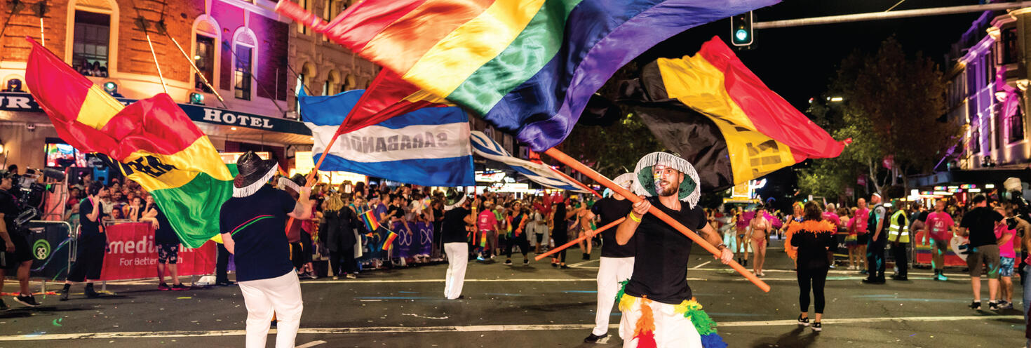
Sydney Gay & Lesbian Mardi Gras Parade
Oxford St, Flinders St, Anzac Pde - Sydney CBD, Darlinghurst and Moore Park
-
Pre-parade entertainment
645pm
Parade start 730pm
Parade finish 11pm
Important Event Information
With major road closures from 3.30pm and tens of thousands of people expected to line the streets for the Sydney Gay and Lesbian Mardi Gras Parade the best way to get to and from the event is by public transport.
Top tips to plan your night:
- Leave the car at home - trains, metro buses and light rail run frequently to the city and some additional late night services will run to help you get home again. Please note transport will not run to a 24 hour timetable on Parade night.
- If you’re catching the bus, plan ahead as services to and from the city will be using different routes and stops while roads are closed between 3.30pm and 2am. See interactive road closure map.
- Transport isn’t free on Mardi Gras night, remember to tap your Opal card or major debit/credit card on and off when travelling on public transport services.
- If you’re catching rideshare or taxis be aware that major roads will be closed and you’ll need to continue on foot to get close to the parade viewing areas.
- Choose your parade viewing spot in advance! You will not be able to cross Oxford or Flinders Streets after 7pm. After 7pm you will need to walk around the parade route to get to the other side.
- Make sure you head towards your preferred viewing side of the parade early to secure a spot.
- Northern side viewing (Darlinghurst): Use Town Hall, St James, Martin Place or Kings Cross train stations, or Gadigal Metro station.
- Southern side viewing (Surry Hills) or Moore Park: Use Central station for the southern side. Note, Museum Station will be closed from 5pm due to large crowds. For Moore Park viewing, change for light rail services leaving from Central Chalmers Street.
- Check out the 2025 Mardi Gras parade route map for more details.
- Please note Metro trackwork between Sydenham and Central may affect your trip - catch trains or buses instead.
- Getting around is easy with the Opal Travel app. The Opal Travel app is the official Transport for NSW app to help you get around public transport. You can plan and save your trips, check your travel activities and fares, top up on the go and more. Download the FREE Opal Travel app now.
Stay connected
Keep informed on the night and get real-time updates on transport services, parade viewing area capacities and road closures:
- Event updates: follow the hashtag #MardiGras, @SydneyMardiGras on Instagram, @SydneyMardiGras on Facebook. @SydneyMardiGras on Twitter
- Transport updates: follow @TrainsInfo, @BusesInfo, @FerriesInfo and @SydneyMetro
- Road closures and traffic updates: follow @LiveTrafficSyd or Live Traffic NSW on Facebook. You can also download the Live Traffic NSW app for real-time updates on traffic conditions.
- Road closure and Parade Maps:
- PDF map - Mardi Gras Parade 2025 road closure and clearway map (pdf 1.4MB)
- Interactive web map - TfNSW Interactive road closure and clearways map to easily view the closures in place for the parade.
- Parade route - Check out the Mardi Gras parade route map
Travel on public transport is not free on Mardi Gras Parade night, remember you'll need to use an Opal card or contactless payment method when travelling on public transport.
Opal
You can use an Opal card for all modes of public transport in Sydney and surrounding regions, including metro, trains, buses, ferries and light rail.
Remember to top up your Opal card before you travel to avoid waiting in line at top-up machines. You can top up your card online or at an Opal retailer.
More ways to pay
If you have a contactless-enabled American Express, Mastercard or Visa debit or credit card, or a linked device, you can use it to pay for your travel by tapping on and tapping off at Opal card readers. Available on all public transport services including metro, trains, buses ferries and light rail, contactless payments are another way to pay on the Opal network. Adult Opal fare pricing applies and you will receive Opal benefits, including daily and weekly fare caps.
Volunteers
Sydney Gay and Lesbian Mardi Gras 2025 volunteers are entitled to travel free on public transport from Saturday, 1 February to Monday, 3 March 2025. Volunteers just need to show their Free Travel Pass to transport staff when boarding services. Transport modes covered by this entitlement includes Sydney Trains (non-booked services and Airport station access fee not included), metro, buses, light rail and ferries.
There's plenty of places to see the parade as it travels from Whitlam Square in the Sydney CBD (at Hyde Park intersection of College St and Wentworth Ave) through Darlinghurst and Surry Hills via Oxford Street and Flinders Street then into Moore Park via Anzac Parade.
There are ticketed viewings areas and designated accessible viewing areas on Flinders Street between Oxford and Albion Streets. Everywhere else along the parade route is free and open to the general public, but remember space does fill quickly so arrive early to secure a spot on your preferred side of the parade route.
Pedestrian crossing
Pedestrian crossing of the parade route will be managed from 5pm ahead of road closures, until 7pm when the pre-show parade starts.
Dedicated crossing points will be located on:
- Oxford St at Riley St and Crown St
- Flinders Street at Albion St and Moore Park Rd.
After 7pm, the parade route will be locked down and there will be no crossing until the parade has finished. You will need to walk around the parade route to get to the other side of Oxford or Flinders Streets. Crossing on Anzac Parade in Moore Park remains open via the pedestrian bridges.
Check out the 2025 Mardi Gras parade route map for more details.
Parade viewing areas & transport:
- Northern side in Darlinghurst: arrive at Town Hall, St James or Martin Place stations, or Metro Gadigal station and continue on foot via Park St, WIlliam St and Yurong St. You can also use Kings Cross Station and walk via Darlinghurst Rd.
- Southern side in Surry Hills: arrive at Central Station and continue on foot via Albion St, Campbell St or Goulburn St.
- Moore Park: arrive at Central Station and connect with light rail services leaving from Chalmers Street to Moore Park, alternatively consider walking via Devonshire or Foveaux Streets.
Check out the 2025 Mardi Gras parade route map for more details.
Sydney Metro services are high-frequency, driverless trains running between Sydney’s north-west and south-west via the city.
The M1 Line operates turn up-and-go Metro services running from early morning until late at night.
On Mardi Gras Parade night, Metro services will run every 10 minutes until 5pm then every 8 minutes until midnight, then every 10 minutes until 2am.
Trackwork
Please note that planned weekend trackwork is taking place during the event and Metro services will not run between Sydenham and Central. On Sunday morning, from 2am to 8am, buses replace all trains between Central, Sydenham and Hurstville.
Metro services will continue to run between Tallawong, Martin Place and Central. You may need to change at Martin Place to continue your trip. Catch trains or buses to travel between Sydenham and Central.
Parade viewing areas:
- Oxford Street - Northern side in Darlinghurst: catch metro to Gadigal and exit via Park St to continue on foot via Park St, William St and Yurong St, or alight at Martin Place.
- Oxford and Flinders Streets - Southern side in Surry Hills, catch metro to Gadigal and exit via Bathurst St or Central Station and continue on foot via Albion St, Campbell St or Goulburn St.
- Anzac Parade - Moore Park, catch metro to Central Station and connect with light rail services leaving from Chalmers Street to Moore Park. Alternatively you can walk via Devonshire St or Foveaux St.
For Metro service disruption information, check trackwork and travel alerts or plan your trip using the Trip Planner.
Getting there
Trains will run to a Saturday timetable, with additional services to get you to the parade in the evening and home again. Trains to the city run approximately every 8 minutes on the T1 North Shore Line and City Circle Line, and every 10 to 15 minutes on all other lines.
Please note trains don't run all night on Mardi Gras so if you're planning to leave the city after 1am or 2am, plan ahead.
The closest stations to the start of the parade are Central, Town Hall, Martin Place, St James and Kings Cross, depending on which side of the parade you want to be on.
Closest stations to parade viewing areas
Pedestrian crossing of the parade route will be closed after 7pm, so plan ahead and use the following stations to access the northern or southern side of the parade:
- For access to the northern side of the parade route in Darlinghurst, use Town Hall, St James, Martin Place or Kings Cross stations.
- For access to the southern side of the parade route in Surry Hills use Central Station.
- You can also catch the Light Rail to Moore Park from Central Chalmers Street to access viewing areas on Anzac Parade.
Note: Museum Station will be closed and trains will not stop from 5pm on Saturday until 4am Sunday due to large crowds and road closures in the area for the parade.
For information on using the train network with a wheelchair or other accessibility needs, including using help points at stations and onboard trains to contact staff, see our trains accessibility page.
Getting home
Additional late night services will run to help you get home after the parade from Central, Town Hall, St James and Martin Place stations.
Keep in mind that trains do not run all night on Mardi Gras, so if you’re heading home after 1am on certain lines you’ll need to catch a NightRide bus instead.
Trackwork may also affect your trip - metro will not run between Sydenham and Central, and from 2am trains will not run between Central and Wynyard or on the city circle, and between Central, Sydenham and Hurstville,
- T1 North Shore Line: trains run every 7 to 8 minutes between the city and Lindfield, Berowra and Hornsby. An additional late night train will run at 10.50pm from Central, all stops to Hornsby. Last service (all stations to Hornsby via North Sydney) leaves Central at 1:16am.
- T1 Western Line: trains leave every 15 minutes between Central and Penrith until 1am. Additional trains will leave Central at 12.11am stopping at Redfern, Strathfield, Lidcombe, Auburn, Clyde, Granville, Harris Park, Parramatta, Westmead, Seven Hills, then then all stations to Penrith, and at 12.41am stopping at Redfern, Strathfield, Lidcombe, Auburn, Clyde, Granville, Harris Park, Parramatta, Westmead, Seven Hills, Blacktown, then all stations to Penrith. Last service leaves Central 1:38am, stopping at Redfern, Strathfield, Lidcombe then all to Westmead, Seven Hills, then all to Penrith. Change at Parramatta for Richmond line services, leaving every 30 minutes until 12:35am.
- T9 Northern Line: trains run every 15 minutes between Hornsby and Central via Epping until 1am. Last service (all stations to Hornsby) leaves Central at 1:04am.
- T2 Inner West & Leppington Line: trains leave the city towards Homebush via all Inner West stations every 15 minutes until midnight and towards Leppington every 15 minutes until 1am. Last service to Newtown (via Homebush) leaves Central at 1:02am. Last service to Leppington via Granville leaves Central at 1:14am.
- T3 Liverpool & Inner West Line: trains leave the city every 15 minutes towards Liverpool and Lidcombe until 1am. Last service to Bankstown leaves Lidcombe at 1.56am and last all-stops service to Liverpool via Regents Park leaves Central at 1:02am.
- T4 Eastern Suburbs & Illawarra: shuttle trains will run between Bondi and Central every 10 minutes until 11pm then every 15 minutes until 3am. Trains will run every 15 minutes between Bondi Junction, the city and Sutherland until 9:45pm, then every 30 minutes until 12:54am. Trains between Waterfall and Bondi Junction will run every 30 minutes until 12.42am. The last train to Cronulla via Sutherland leaves Central at 1.32am. From 2am to 8am, buses replace all trains between Central, Sydenham and Hurstville.
- T6 Lidcombe and Bankstown Line: trains run every 20 minutes between Lidcombe and Bankstown until 1:56am. Last service to Bankstown leaves Lidcombe 1:56am.
- T7 Olympic Park: sprint shuttle trains run between Lidcombe and Olympic Park every 10 minutes until 12:30am for fans attending the Kylie Minogue concert.
- T8 Airport & South Line: trains leave the city every 15 minutes to Macarthur via the Airport Line and to Revesby via the Airport Line until 9.18pm. Last service to Macarthur leaves Central at 1:02am.
- NSW TrainLink services:
- Blue Mountains Line: Most trains run between Blue Mountains Line stations and Blacktown only. Change trains at Blacktown to continue your trip. Last service to Lithgow leaves Blacktown at 1:28am, stopping at Penrith, Emu Plains then all stops to Lithgow.
- Central Coast & Newcastle Line: Most trains run between Central Coast & Newcastle Line stations and Strathfield only. Change at Epping for metro services to the City or change trains at Strathfield to continue your trip. All services arriving and departing Strathfield between 5pm and midnight will be built up to 8 cars. Last service to Newcastle Interchange leaves Strathfield at 1.48am.
- Southern Highlands Line: Services will run to a regular Saturday timetable. Last service to Moss Vale leaves Campbelltown at 12.54am.
- South Coast Line: All services arriving and departing Central between 5pm and midnight will be built up to 8 cars. An additional train to Wollongong will leave Central at 23:59, stopping at Redfern, Wolli Creek, Hurstville, Sutherland, Waterfall then all stations to Wollongong. The last service to Wollongong/Port Kembla leaves Central at 1.36am stopping at Hurstville, Sutherland, Waterfall, Helensburgh, Thirroul, North Wollongong, Wollongong then all stations to Port Kembla
Trackwork
Weekend trackwork is taking place on Saturday 1 and Sunday 2 March and may affect how you travel to and from the event. Plan ahead using the Trip Planner.
- City Circle: Sunday from 2am to 4pm, trains will not run on the City Circle, or between Central and Wynyard. For travel around the City use the light rail or local bus services. T4 Eastern Suburbs Line trains continue to run between Central and Bondi Junction
- M1 Metro North West & Bankstown Line: Metro services run between Tallawong, Martin Place and Central only, to a reduced frequency. Change at Martin Place for metro services towards Tallawong or Central, or T4 trains to Sydenham. From 2am to 8am, buses replace all trains between Central, Sydenham and Hurstville.
- T1 Western Line: Richmond trains run to a changed timetable and stopping pattern between Richmond and Olympic Park only. Change trains at Parramatta to continue your journey towards the City.
- T4 Eastern Suburbs & Illawarra Line: All Cronulla and some Waterfall trains make extra stops at St Peters and Erskineville. Metro services run between Central, Martin Place, and Tallawong only.
- T8 Airport & South Line: T8 trains do not run between Sydenham and the City Circle. T4 trains run between Sydenham and Bondi Junction, with some trains making extra stops at St Peters and Erskineville. Metro services run between Central, Martin Place and Tallawong only.
- South Coast Line: From 7.30am to 11.30am, at Waterfall and Helensburgh, all trains leave fr
- Central Coast & Newcastle Line: Most trains run between Central Coast & Newcastle Line stations and Strathfield only. Change at Epping for metro services to the City or change trains at Strathfield to continue your journey. Some late night or early morning trains will run around the City Circle.
- Blue Mountains Line: Most trains run between Blue Mountains Line stations and Blacktown only. Change trains at Blacktown to continue your journey. Trains from Blacktown to Blue Mountains Line stations run up to 30 minutes later than the normal timetable. Some late night or early morning trains will run around the City Circle. Bathurst trains run to the normal timetable between Bathurst and Central.
Trackwork is carried out on an ongoing basis to maintain the safety, reliability, and efficiency of the Sydney Trains network. For train service disruption information, check trackwork and travel alerts or plan your trip using the Trip Planner.
Buses to the city run regularly on weekends with extra services running on key routes to help you get to the parade. Additional late-night services will also run to help you get home. Plan your trip using the Trip Planner.
The closest major bus terminals are at Central and QVB Town Hall, or in Kings Cross.
Check out the 2025 Mardi Gras parade route map for more details.
Please note that buses between the city and eastern suburbs will be affected while roads are closed for the parade. A number of routes will be diverting around the closures, using alternative stops or ending trips early, so you may need to walk further than usual for access to the parade viewing areas.
Bus diversions
Buses between the city and eastern suburbs will be diverting between 3pm and 3am while roads are closed, using different stops and/or terminating early. Allow extra travel time and plan your bus trip ahead of time.
All stops on Oxford St between Hyde Park and Flinders St, and some stops on Anzac Pde will not be accessible. Buses will be diverting around Oxford St and Anzac Pde via Kings Cross or Surry Hills. Be prepared to walk further than usual to access the parade route.
Buses from the east travelling on Oxford St will divert via Kings Cross in both directions. Buses from the south and south east will divert via Central Station in both directions. Allow extra travel time and plan your bus trip ahead of time using the Trip Planner.
Road closure and Parade Maps:
- PDF map - Mardi Gras Parade 2025 road closure and clearway map (pdf 1.4MB)
- Interactive web map - TfNSW Interactive road closure and clearways map to easily view the closures in place for the parade.
- Parade route - Check out the Mardi Gras parade route map
Eastern suburbs route diversions
- Route 304:
- From 4.30pm to 9pm and 9pm to 11.30pm services to the city will be diverting via Foveaux St, Elizabeth St then as normal. Services leaving the city will divert via Albion St and Crown St.
- From 9pm to 11.30pm services will start and end trips at Central instead of Circular Quay. Services to the city will divert via Crown St, Foveaux St into Elizabeth St and end trips at Eddy Ave Stand A at Central. Services leaving the city will start trips from Eddy Ave Stand C and travel Elizabeth St, Albion St, Crown St then as normal.
- Route 311: from 3pm to 2.30am services will start and end in Kings Cross and will not run between Kings Cross and Central. Buses from Millers Point will end trips at Kings Cross Station, Darlinghurst Rd, Stand B (Stop ID 201112). Services towards Millers Point will start trips from Kings Cross Station, Darlinghurst Rd, Stand A (Stop ID 201111). Catch trains to continue your trip between Kings Cross and Central.
- Route 333:
- From 4.30pm to 9pm and 11.30pm to 3am: services will divert around Oxford St through Darlinghurst via Kings Cross. All stops on Oxford St between Hyde Park and Flinders St will be missed. Services to the city will divert via Darlinghurst Rd, Craigend St, William St, Park St, Elizabeth St then as normal. Services leaving the city will travel via Elizabeth St, Park St, left William St, Kings Cross Rd, Victoria St, Oxford St then as normal.
- From 9pm to 11.30pm additional roads in the CBD will be closed for crowd bump out, during this time buses leaving the city will divert via Elizabeth St, St James Rd, Prince Albert Rd, College St, William St, Kings Cross Rd, Victoria St then continue Oxford St. All stops on Oxford St between Hyde Park and Flinders St will be missed.
- Route 339:
- From 2.30pm to 4.30pm the Moore Park Busway will be closed, buses will run to and from the city as normal but use stops on Anzac Pde instead of the busway.
- From 4.30pm til last service buses to the city will be diverting via Anzac Pde, Cleveland St, Crown St, Foveaux St then as normal. Services leaving the city will divert via Albion St, Crown St, Cleveland St, Anzac Pde then as normal. Stops on Albion St, Oxford St, Museum and Flinders St will be missed in both directions.
- Route 343: From 9pm until 11.30pm services will start and end trips at Central Station instead of Circular Quay. Change for trains to continue your trip. Buses from Kingsford to Circular Quay will end trips at Central, Eddy Ave Stand A. Services leaving the city towards Kingsford will start trips from Elizabeth St Stand E near Kippax St (Stop ID 201080).
- Route 352: From 4.30pm until last service buses between the city and Marrickville will be diverting around Oxford St and Flinders St closures in Darlinghurst via Lang Rd, Cook Rd and Moore Park Rd in both directions. All stops on Crown St and Oxford St will be missed in both directions.
- Route 373:
- From 2.30pm to 3.30pm the Moore Park Busway will be closed, buses will run to and from the city as normal but use stops on Anzac Pde instead of the busway.
- From 3.30pm to 3am buses will start and end at Central instead of Museum. Buses will be diverting via Anzac Pde, Cleveland St, Crown St, Foveaux St, Elizabeth St, Hay St, Pitt St and Eddy Ave dropping off at Stand D on Eddy Ave. Services leaving the city will pick up from Eddy Ave Stand C and will travel via Albion St, Crown St, Cleveland St, Anzac Pde, Alison Rd then as normal.
- Route 396:
- From 4pm to 9pm and 11.30pm to 4am services will be diverting via Anzac Pde, Cleveland St, Chalmers St, Randle St into Elizabeth St, then as normal. Services leaving the city will divert via Cleveland St and Anzac Pde. Stops on Oxford St and Flinders St will be missed.
- From 9pm to 11.30pm additional road closures in the CBD will be in place. Services will start and end trips at Central instead of Circular Quay. Services to the city will be diverting via Cleveland St, Chalmers St, Randle St into Elizabeth St and end trips at Eddy Ave Stand A at Central. Services leaving the city will start trips from Elizabeth St Stand E near Kippax St (Stop ID 201080) and divert via Cleveland St and Anzac Pde.
- Route 392N: from midnight until 4am services will divert via Cleveland St, Chalmers St, Randle St into Elizabeth St then as normal. Services leaving the city will divert via Cleveland St and Anzac Pde.
Inner West route diversions
- Route 389: From 6.30pm to 1am services to Bondi Junction will divert via Riley St, Sir John Young Crescent, Crown St and Stanley St. Services towards Pyrmont will divert Crown St and William St. No stops will be missed.
- Routes 412, 423, 426, 428, 430, 431 and 470: From 9pm to 11.30pm buses will start and end their trips at Central Station instead of Martin Place. Buses to the city will end trips at Pitt St before Hay St (Stop ID 2000434) near Belmore Park, Central. Buses leaving the city will start trips from Pitt St opp Barlow St (Stop ID 200083) near Belmore Park, Central. Catch trains or metro services to continue your trip between Central and Martin Place.
- Routes 438n, 438x, 461n and 461x: From 9pm until 11.30pm buses will start and end their trips at Central Station instead of Martin Place. Buses to the city will end trips at Hay St opp Belmore Park (Stop ID 2000428). Buses leaving the city will start trips from Haymarket Light Rail Stop Rawson Pl (Stop ID 2000163). Catch trains or metro to continue your trip between Central and Martin Place.
- Route 440:
- From 3.30pm to 9pm and 11.30pm to 3am: services will divert around Oxford St via Elizabeth S, Park St, William St and Darlinghurst Rd/Victoria St in both directions. All stops on Oxford St through Darlinghurst, and stops on Wentworth Ave and Liverpool St will be missed.
- From 9pm to 11.30pm: route 440 services will between Rozelle and the city only. Catch trains between Bondi Junction and Central to continue your trip. Rozelle – City: buses will start and end trips at Central Station. Services to the city will end trips at Central Station Eddy Ave Stand C (Stop ID 200053). Services towards Rozelle will start trips from Haymarket Light Rail Stop Rawson Pl (Stop ID 2000163). Catch trains between Central and Bondi Junction to continue your trip.
Night Rides:
Additional NightRide buses will run on some routes between 12am and 4am to help you get home.
Note some buses that usually depart from Town Hall will depart from Museum station instead between 12am and 1am Sunday morning due to road closures in the city for the parade.
The following NightRide services will depart from Museum Station, Castlereagh St Stand F (ID: 200058) instead of Town Hall Park St, Stand H.
- N40 – 12:10am, 12:40am
- N50 – 12:04, 12:34am
- N60 – 12:40am
- N61 – 12:30am
- N71 – 12:29am
Missed stops: Town Hall, Park St, Stand H (Stop ID 2000249). Check signs at stops for alternative bus stop locations and allow extra travel time.
For bus service disruption information, check travel alerts or plan your trip using the Trip Planner.
Catch a ferry to Circular Quay to connect with trains to St James, Town Hall or Central to get within walking distance of the parade. You can also catch a light rail service from Circular Quay to Town Hall.
Keep in mind that ferries are expected to be busy and services may reach capacity early so have a back up plan in mind and consider the alternative transport options available.
For ferry service disruption information, check travel alerts or plan your trip using the Trip Planner.
L1 Dulwich Hill Line
L1 Dulwich Hill Line light rail services run between Central Grand Concourse and Dulwich Hill from 5am daily. Use the Trip Planner to plan your trip.
On Mardi Gras light rail services will extend until 2am.
Access to the parade viewing areas:
- The closest stop to the southern side of the parade is Central Grand Concourse where you can walk via Albion St.
- For access to the northern side of the parade route change at Central for a train to Town Hall or metro to Gadigal to continue on foot.
- For access to Anzac Pde viewing areas change at Central for light rail services from Central Chalmers Street to Moore Park
- Check out the 2025 Mardi Gras parade route map for more details.
L2 Randwick and L3 Kingsford Lines
L2 Randwick Line light rail services run between Circular Quay and Randwick via Central Station (Chalmers Street) and the L3 Kingsford Line services run between Circular Quay and Kingsford via Central Station (Chalmers Street). Services run from 5am daily.
On Mardi Gras light rail services will extend until 2am. Additional services will run on the L2/L3 lines from 4pm to 7pm between Circular Quay and Juniors Kingsford/Randwick, with a high frequency event shuttle running between Central and Moore Park from 5pm to 6:30pm and from Moore Park to Central from 10pm to 11:30pm.
Access to the parade viewing areas:
- The closest stop to the southern side of the parade route is Central Chalmers Street or Surry Hills where you can walk via Devonshire Street.
- The closest stop to the northern side of the parade route is Town Hall where you can walk via Park Street and William Street.
- The closest stop to the Anzac Parade viewing areas is Moore Park where you can access either side of Anzac Pde via the Albert 'Tibby' Cotter Walkway.
- Check out the 2025 Mardi Gras parade route map for more details.
Additional services will run. Plan your trip using the Trip Planner.
For more details on stop locations and maps, see light rail service information. For light rail service disruption information, check travel alerts or plan your trip using the Trip Planner.
Spectators are urged to leave the car at home as major road closures and widespread parking restrictions will be in place in the city, Darlinghurst and Moore Park from 3.30pm on Saturday 1 March and most roads remain closed until 2am, Sunday 2 March.
Pedestrian access across the parade route will be maintained at Riley St, Crown St and Albion St until 7pm, after such time there is no pedestrian crossing of Oxford or Flinders Streets available until the parade has concluded.
Road closure, clearway and Parade Maps:
- PDF map - Mardi Gras Parade 2025 road closure and clearway map (pdf 1.4MB)
- Interactive web map - TfNSW Interactive road closure and clearways map to easily view the closures in place for the parade.
- Parade route - Check out the Mardi Gras parade route map
Key road closure timings
- From 3:30pm to 1am: sections of College St, Wentworth Ave, Goulburn St and surrounding local streets.
- From 4pm to 2am: Flinders St northbound lanes from Moore Park Rd to Oxford St and sections of Bourke St, Albion St, Campbell St and surrounding local streets in Surry Hills as well as local streets in Darlinghurst including Forbes St and Foley St. -
- From 5pm to 1am: In Surry Hills/CBD South, closures will be in place on Liverpool St westbound from College St to Elizabeth St, and sections of Nithsdale St, Clarke St and Commonwealth St in Surry Hills. The following roads in Surry Hills will also close but have managed access for residents, including Reservoir St, Commonwealth St, Riley St, Campbell St and surrounding local roads.
- From 5pm to 2am: Oxford St between College St and Darlinghurst Rd, Flinders St southbound from Oxford St to Moore Park Rd, Crown St between Albion St and Burton St, sections of South Dowling between Oxford St and Fitzroy St, and Anzac Pde between Moore Park Rd and Lang Rd, including the Eastern Distributor Randwick exit. Other roads in Surry Hills and Darlinghurst adjoining Oxford and Flinders St will also be closed.
- Anzac Pde and Oxford St detours: From 5pm all citybound traffic on Anzac Pde will be diverted via Cleveland St or Lang Rd, and all citybound traffic on Oxford St will be diverted via Darlinghurst Rd.
- Eastern Distributor closures: Eastern Distributor (ED) Anzac Pde Randwick exit will be closed from 5pm, and there will be no access to the ED northbound from Anzac Pde. Entry to the ED maintained until 6.30pm via Moore Park Rd. After 6.30pm, access the ED via South Dowling St. The ED Moore Park Rd Bondi exit remains open at all times.
- From 6.30pm to 1am: Moore Park Rd westbound from Oatley Rd to South Dowling St, including Eastern Distributor entry ramp, Greens Rd, Driver Ave and nearby local streets.
- Contingency road closures between 9pm and 11.30pm approximately (at the direction of NSW Police): sections of Elizabeth St and Castlereagh St between Market St and Goulburn St may close to allow crowds to safely leave the CBD.
- Other local closures in Surry Hills: sections of Patterson Lane, Short St, Hill St, Floods Place, Marys Place and Short Place will be closed at varying times before and after Parade between Friday 28 Feb and Monday 3 March for Parade infrastructure set up and the Laneway Festival on Sunday 2 March. Managed access for residents will be maintained outside of Parade operational hours.
Motorists are urged to avoid unnecessary travel in the CBD and to expect delays as traffic will be heavy on detour routes.
Motorists travelling between the city and eastern suburbs will be diverted via Cleveland St in the south or via William St and Darlinghurst Rd in the north.
Reminder: it is a fineable offence to drive on, or exit a driveway onto, a closed road. Access to your property and/or parking may be restricted due to closures and clearways, so please familiarise yourself with the road closure and clearway information when planning your movements on the day.
Cycleway closures
- From 6am to midnight Sat 1 Mar:
- Park St (cycle lane) between College St and Elizabeth St westbound
- William St (cycle lane) between Yurong St and College St westbound
- From 3.30pm to 1am Sat 1 Mar:
- College St between Liverpool St and Park St
- From 4pm Sat 1 Mar to 3am Sun 2 Mar:
- Fitzroy St (cycle lane) between South Dowling St and Bourke St
- Bourke St between Fitzroy St and Campbell St
- Campbell St between Crown St and Bourke St
- From 5pm Sat 1 Mar to 2am Sun 2 Mar
- Liverpool St between College St and Elizabeth St
- Oxford St Between College St and Flinders St
- From 9pm to 11:30pm approx. Sat 1 Mar:
- Liverpool St (cycle lane) between Castlereagh St and George St westbound
For detailed closure and clearway listings and maps, visit Live Traffic NSW, or download a real-time traffic app.
Parking
With carparks in the city expected to fill early and extensive restrictions on street parking in place, it's best to leave the car at home and take advantage of the additional public transport services running to get you to and from Mardi Gras celebrations.
If you have to drive and park your vehicle be aware that roads may close around your parked location. Vehicles are not permitted to drive on closed roads or exit car park driveways onto closed roads at any time unless at the direction of NSW Police.
For parking options in the Sydney CBD visit City of Sydney - Parking.
Special event clearways
Special event clearway parking restrictions will be in effect on major roads along the parade route in the Sydney CBD, Darlinghurst, Surry Hills and Moore Park from 6am, Saturday 1 March until 2am, Sunday 2 March including Oxford Street, Flinders Street, College Street, Wentworth Avenue, Park Street and Liverpool Street.
Look for the bright yellow signs and read them carefully when parking your vehicle on the day or the night before as clearways come into effect early in the morning. Vehicles left in clearwayed areas will be towed.
- From 6am Saturday 1 March until 2am Sunday 2 March including Oxford Street, Flinders Street, College Street, Wentworth Avenue, Park Street and Liverpool Street. Clearways will also be in effect on roads surrounding the parade and along detour routes
- From 11am Saturday 1 March until 2am Sunday 2 March including Elizabeth Street, Castlereagh Street, Campbell Street, Pitt Street, Cleveland Street, Darlinghurst Road, Chalmers Street, Goulburn Street, Bathurst Street, Liverpool Street, Eddy Avenue, Fitzroy Street, Foveaux Street, Driver Ave, Lang Road, Moore Park Road and various surrounding local roads.
- From 5pm Saturday 1 March to 3am Sunday 2 March on Bayswater Road between Kellett Street/Pennys Lane and Ward Avenue in Potts Point.
- Note some clearways will be in effect on Flinders Street from 10pm Friday 28 February.
Road closure, clearway and Parade Maps:
- PDF map - Mardi Gras Parade 2025 road closure and clearway map (pdf 1.4MB)
- Interactive web map - TfNSW Interactive road closure and clearways map to easily view the closures in place for the parade.
- Parade route - Check out the Mardi Gras parade route map
Clearways are strict no-parking zones, and apply even to residents and businesses with parking permits or TfNSW Mobility Scheme permit holders. Vehicles left in special event clearways will be towed and a fee applies. If your car is towed, call 132 701 to find its new location.
For the latest traffic conditions, listed clearway locations and maps visit Live Traffic NSW or download a real-time traffic app from the App Store or Google Play.
Viewing areas
The accessible viewing area is located on Flinders Street between Patterson Lane and Linden Lane.
All guests with accessibility requirements need to register for the accessible viewing area. For more information, see accessible viewing options.
All patrons who register with SGLMG must get off at train at Central Train Station in. From Central Station you will then have access to the free Shuttle Bus service departing from Foveaux Street.
For more details on accessible viewing areas and connecting shuttle buses please visit Mardi Gras – Accessibility.
Taxis & Drop-Off Zone
Wheelchair Accessible Taxi (WAT) bookings can be made via Zero200. Bookings must be made prior to the Mardi Gras Parade night through Zero200.
An accessible taxi/rideshare drop-off and pick-up zone will be available on the corner of Albion and Bourke Streets, Surry Hills.
Transport
Accessible trips are shown in the Trip Planner with the wheelchair icon. You can check 'accessible services only' in the Options to ensure you only see accessible services. Only trip plans with accessible train platforms, ferry wharves and buses will be presented. See accessible travel or download a transport app (check the 'Accessibility' filter).